MARKER FILERecord dated
The shape of Denton County: Blackland Prairie, Cross Timbers and county lines
The shape of Denton County, Texas: Blackland Prairie farmland, Cross Timbers woodland, river bottoms and how the county lines came to be drawn.
Filed 10 min readBy the Blackland Chronology editorial team
Texas Historical Commission marker files record what an application stated and when the commission accepted it. The files do not publish which statements were checked against a deed, a plat or a census return.
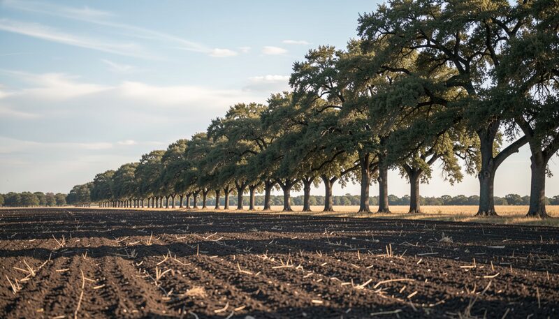
Ask what Denton County looks like and many people reach for a road map, tracing the square-ish outline that sits one county south of Oklahoma. The outline is real, but it hides the more interesting shape underneath: a county cut in three by soil and timber, with black prairie on the west, a sandy wooded belt through the middle, and rich blackland again along the eastern edge. That physical shape decided where settlers stopped, where railroads ran, and where the towns ended up. It also shaped the political map, because the county line was drawn across this ground in 1846 and then lived with the consequences.
The Texas State Historical Association gives the plain numbers. Denton County covers 911 square miles in north central Texas, with its centre point at 33°12' north latitude and 97°13' west longitude. It borders Dallas and Tarrant counties on the south and Cooke and Grayson counties on the north. Anyone comparing this to the wider set of Texas county boundary maps will see the same block on the page, but the block is only the beginning of the story.
The county line was drawn in 1846
The Texas legislature formed Denton County in 1846 out of what had been a much larger Fannin County. It took its name from John Bunyan Denton, a Methodist preacher and lawyer from eastern Fannin County, who was killed in a raid against Indians in northern Tarrant County on May 22, 1841. For a family historian, that date matters twice over: it explains the name on the deed books, and it marks the moment the records of this ground stopped belonging to Fannin County and started belonging to a new one. If your people appear in Fannin County records before 1846 and Denton County records after, this is why. The wider story of how the county filled up with people and paper is traced in the county history overview, and it runs alongside the geography at every step.
What is the physical shape of Denton County?
Think of three bands running roughly north to south. The western half of the county is surfaced by the black soil of the Grand Prairie. An eastern sliver sits on the western edge of the Blackland Prairie, where that rich black soil contrasts sharply with the sandy land of the Eastern Cross Timbers. That timbered belt juts down from Oklahoma through the central part of the county, separating the two prairie zones with a strip of sand and trees. Elevation across the county ranges from 500 to 900 feet, so nothing here is mountainous, but the ground rolls enough to matter. Average rainfall runs about thirty-three inches a year, and the temperature average swings from a minimum of 34°F in January to a maximum of 96°F in July. With a growing season averaging 226 days, the county has long been good ground for general crop and livestock production.
Where the water runs
The Elm Fork of the Trinity River flows through the east central part of the county. It was dammed in the 1920s to form Lake Dallas, which has since been joined with the Garza-Little Elm Reservoir to form Lewisville Lake, a moderately large reservoir. The western part of the county is cut by several major creeks. Clear Creek drains into the Elm Fork, and Hickory Creek drains into Lewisville Lake. In the southern part of the county, Denton Creek and its tributaries feed Grapevine Lake, which lies partly in Denton County and partly in Tarrant County. Those floodplains are not empty ground. In the Cross Timbers and along the creek bottoms, black jack and post oak, pecan, white ash, sycamore, cottonwood, hackberry, elm, and willow trees predominate. Most of the rest of the county was originally covered by grasses.
Where the first settlers stopped
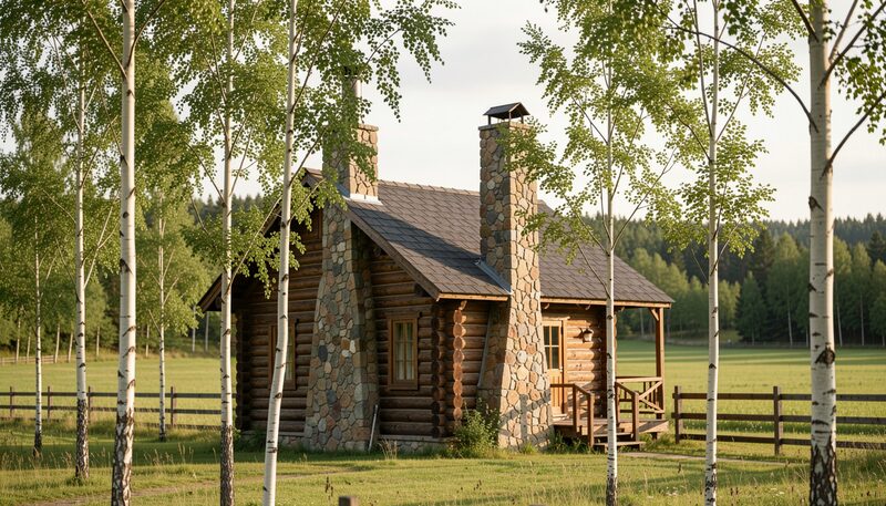
Anglo settlement began after William S. Peters, of Louisville, Kentucky, and several others obtained a land grant from the Texas Congress in 1841. The land settled by their company, the Texian Land and Immigration Company, became known as the Peters colony, and the grant included all of the future Denton County as well as parts or all of several other future counties. The earliest settlement in what became Denton County was in the southeastern section, near the site of present Hebron, and most of the early residents took up land in the Cross Timbers. That choice follows the ground. Timber meant building material, fencing, fuel, and shelter from the wind, and the creek bottoms running through that belt meant water. The prairie soils that would later carry wheat were open, heavy, and hard to break without the right tools. You can follow how the ground steered those first households in the account of Pioneer Settlement.
Why so few settlers came from the deep South
Although a few came from the lower South, most antebellum settlers in the area came from the upper South. In 1850, 40 percent of them gave Tennessee and Kentucky as their state of birth. Immigration from the upper South predominated because of the Kentucky-based Peters Company. The county was also limited to subsistence agriculture because it had no water transportation, and that limit shows up in the census counts: only 106 slaves in the county in 1850, and by 1860, eighty-seven slaveholders owning 251 slaves. Two short-lived experiments left marks of different sizes. In the 1840s the county hosted the Icarian colony, a French utopian settlement north of the site of present Justin, which the colonists gave up after a few months of sickness and disappointment and which left virtually no lasting mark. The German community of Blue Mound, on the prairie a few miles northwest of Denton, is a different case. Descendants of many of the German families who began settling there in the 1870s were still among the community's residents a century later, most of them from Saxony by way of Illinois or Missouri.
How a county seat kept moving
The political shape of the county took longer to settle than the boundary did. A county seat named Pinckneyville was located near the centre of the county, about a mile southeast of the present centre of Denton. County officials were elected in 1846, but no courthouse was built there, and less than two years later a site named Alton, three or four miles to the southeast, was made county seat. Water was not readily available at Alton, so in 1850 the legislature allowed the town to be moved about two miles south to Alexander Cannon's homestead near Hickory Creek. A log courthouse, the first in the county, was built there, and Alton soon had stores, residences, and a hotel and served as a regular stage stop. In the summer of 1856, however, county residents voted to establish a new county seat near the centre of the county on a 100-acre tract donated by Hiram Cisco, William Loving, and William Woodruff. The new town, named Denton, was established the next year and incorporated as a city in 1866. Every one of those moves was a decision about water, about the middle of the county, or about both, which is why the county's location and boundaries are worth reading next to its court minutes rather than on their own.
What the railroads did to the map
Railroads entered the county in the 1880s and had a great economic and demographic effect. Subsistence crops such as corn and vegetables declined, cotton and wheat acreage increased rapidly, and the number of cattle grazing the prairies shrank substantially. Cotton acreage stood at 29,785 acres in 1880 and peaked at 115,078 in 1920 before declining to insignificance in the 1980s. The Grand Prairie proved ideal for wheat, and between 1880 and 1900 wheat acreage increased by more than 80,000 acres. From 1890 to 1920 the county ranked either first or second in wheat production among the counties of the state, behind Collin County, and Krum, a village near Denton, was reputed in 1900 to be the largest inland wheat market in the United States. Beef cattle declined from 49,008 head in 1880 to 12,123 in 1920, by which date 89 percent of county land was in cultivation. The routes were not random. How the lines crossed the prairie and the timber is set out in the story of the towns They Made, and the result lasted: up to the 1970s only one town of any size was not on one of the railroad lines built in the 1880s.
What sits under the soil
The Trinity Sands underlie the area at about 700 to 1,200 feet, but in some parts of the county residents are able to reach artesian water at depths as shallow as 100 feet. Denton County is not abundant in natural resources, though it has produced a modest but significant amount of oil, 5,696,311 barrels by the end of 2004, mostly from the Bolivar field between the 1930s and the 1960s. Other resources are natural gas, sand and gravel, and some building stone. The stone courthouse on the square in Denton was built in 1896 from stone quarried a few miles north, which is the physical shape of the county written into its most public building.
The shape the county wears now
Rubber-tired transportation and, to a lesser extent, the location of Dallas-Fort Worth International Airport played a large part in the county's growth after 1940. During World War II the county began to serve noticeably as a bedroom area for Dallas and Fort Worth. Completion of Interstate Highway 35 in the 1950s increased commuting, and in the 1980s Interstates 35E and 35W forked in Denton. All of the county's towns and cities had a significant commuter element, but the southeastern portion, growing most rapidly, became virtually an extension of Dallas and Fort Worth. Lewisville, The Colony, and the part of Carrollton inside Denton County grew as Dallas suburbs, while Denton itself grew on its proximity to Dallas and on the University of North Texas and Texas Woman's University. The population rose from 47,432 in 1960 to 143,126 in 1980, and the 2014 census counted 753,363 people. Newcomers and many older residents returned much of the county's rich cropland to pasture, and by the 1980s rural areas, almost emptied by the rural-to-urban shift after World War II, had probably returned to their 1920s density of population. In 2002 the county had 2,358 farms and ranches covering 349,000 acres, 48 percent in pasture and 46 percent in crops, earning $49,102,000, of which livestock sales accounted for $37,338,000. Horses, eggs, nursery plants, turf, and cattle were the chief products. The largest cities are Denton, with 121,122 people, and Lewisville, with 100,237.
Go outside on a clear evening and the two halves of the county are still legible: open ground to the west, a dark band of post oak and black jack through the middle, blackland again to the east, and the Elm Fork running through it. The boundary lines on the map were drawn in Austin, but the bands were drawn by geology, and they are the reason a deed from the 1850s places a family in timber rather than on prairie. Pull the tract description for your own people and ask which band it falls in.
About the entry cited here
The Handbook of Texas Online is published by the Texas State Historical Association at tshaonline.org. Its Denton County entry carries the county's geography, its formation in 1846, settlement, agriculture, transportation, education, and population history in a single signed article, with a bibliography and a preferred citation for each entry. The entry used here was written by E. Dale Odom.
The Blackland Chronology editorial team, contact@dentoncountyhistoricalmuseum.com

What this entry rests on
- 1860MARKER FILEThe county line was drawn in 1846
- 1860CENSUSWhat is the physical shape of Denton County?
- 1860DEEDWhere the water runs
Corrections to this entry
- : first publication, no correction recorded yet.